Last year contained some sobering events for me. I took a hard fall, and watched my panicked horse vanish into 5000 acres of wilderness (fortunately, he was found quickly along the trail). I heard multiple stories about riders who suffered similar incidents and did not fare so well–one horse was found too late and died, and another wasn’t found at all. Dancer’s fate is still a mystery.
Because of this, I began investigating GPS trackers. These gadgets–of which there are a multitude on the market–help people find missing items from car keys to kids. I learned a fair amount along the way, as well. Many trackers only work off cell phone signals (not helpful to equestrians) and have limited ranges. Some hype no monthly charges, but the ones I investigated were very limited in range and ability.
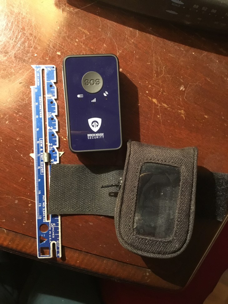
The tracker I chose works off both cell towers and GPS satellites. It cost about $80, and requires a $10 per month service charge. It is supposed to work anywhere in the United States as well as in heavy tree and cloud cover. It’s water-resistant (not waterproof). It has an SOS button, which will send an immediate email and text to my emergency contact when pushed. If I lose my horse, I can use an app on my cell phone and “ping” him. Alternatively, my husband can log into the website and call up the map showing my horse’s location. And it’s small enough to attach to my horse’s bridle (I position it on the top, between the horse’s ears–placing it on the side dragged the bridle down slightly, as well as risked soaking when we went through heavy water).
While I hope and pray I NEVER need to use it, I’m glad I got it. I feel safer, and don’t worry nearly as much about what could happen to my beloved horse.